Subsidance Identification using GIS
- GIXconsulting
- Jul 23, 2021
- 1 min read
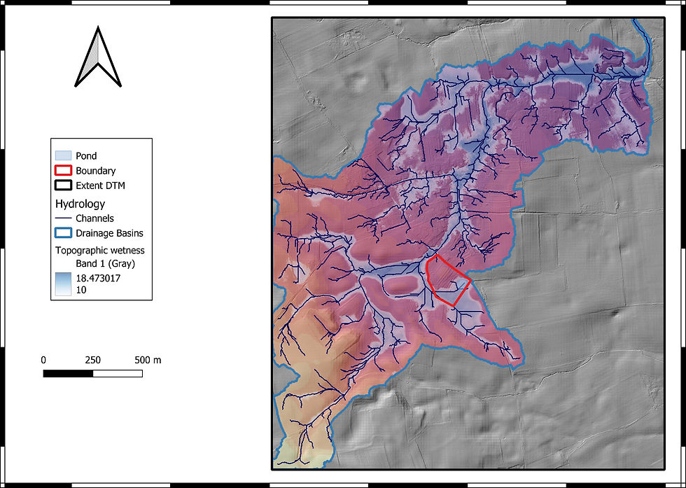
This project used GIS in conjunction with drilling work to determine whether or not a pond near the site formed as a result of gypsum dissolution.

This project used GIS in conjunction with drilling work to determine whether or not a pond near the site formed as a result of gypsum dissolution.


Comments