

Agriculture
Navigate the complexities of modern farming with GIX Consulting. Harnessing the power of advanced geospatial technologies, we generate actionable insights for each of your fields. From assessing soil health with hyperspectral imaging to monitoring crop vitality using NDVI data, we offer insights grounded in precision. Our commitment? To provide the agricultural sector with data-driven solutions, ensuring every crop cycle is approached with knowledge and foresight.
Agricultural Consulting Services
Our services leverage the capabilities of GIX Consulting in geospatial technologies, aiming to provide actionable insights for the agricultural sector. We'll meet you where you are and create solutions that integrate into your workflows and support targeted interventions.


Growth Rate Assessments
Track crop growth rates and developmental stages using time-lapse imagery, assisting in predicting harvest times and yields.
Digital Elevation Models (DEMs) for Water Management
Utilize LiDAR data to create detailed elevation models, aiding in understanding water runoff patterns and planning effective irrigation systems.
Pest and Disease Detection
Through the analysis of hyperspectral and optical data, detect early signs of pest invasions or disease outbreaks, allowing for timely mitigation measures.
Custom Geospatial Consulting
Tailored solutions for unique agricultural challenges, leveraging our advanced equipment and software to address specific needs.
Achieving Goals


Data Integration with Public Sources
Incorporate data from public sources to provide a comprehensive dataset, ensuring a holistic view of agricultural lands and associated variables.
Continuous Monitoring for Seasonal Changes
With regular data acquisition capabilities, monitor seasonal changes and their impact on crops, aiding in planning for subsequent cultivation cycles.
Efficient Resource Allocation
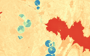
By understanding field variations and crop health zones, assist in the targeted application of resources, from water to fertilizers, ensuring optimal utilization. Monitoring metrics such as dam levels is critical to planning in arid regions.
Efficiency


Precision Crop Health Monitoring
Utilizing NDVI satellite and drone data, monitor the vitality of crops to detect early signs of stress, disease, or pest activity, enabling timely interventions.
Detailed Field Surveys with Drone LiDAR
Capture precise topographical data of farmlands to assist in field planning, irrigation management, and optimizing planting strategies.
Hyperspectral Analysis for Soil Health
Using VNIR hyperspectral data, we assess soil quality and variations. This helps in determining fertilizer requirements, optimizing irrigation, and understanding field variations.