

Consulting
Every industry has unique challenges, and at GIX Consulting, we're ready to meet them. While we have expertise in forestry, agriculture, and environmental sectors, our capabilities aren't limited. If you're in an industry seeking geospatial solutions, we're open to discussions and collaborations. Learn more about how our consulting services can align with your specific needs.
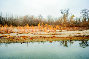
Environmental


Habitat Assessment and Monitoring
Using high-resolution optical and hyperspectral data, assess and monitor diverse ecosystems, identifying changes in vegetation, water bodies, and other key environmental features.
Biodiversity Studies
Leverage drone LiDAR and hyperspectral imaging to study biodiversity, identifying species variations and tracking flora and fauna health.
Landfill Site Assessment and Evolution Tracking
Utilize drone LiDAR, optical, and hyperspectral data to continuously monitor landfill sites. This aids in understanding volume changes, assessing potential leachate spots, and detecting unusual surface activities. Regular monitoring ensures compliance with environmental guidelines and helps in planning future waste management strategies.
Engineering


Infrastructure Planning and Monitoring
Utilize drone LiDAR to obtain detailed topographical data, assisting in infrastructure design, planning, and construction monitoring.
Site Assessment and Pre-construction Analysis
With geospatial data, assess potential construction sites, identifying challenges like unstable terrains, water runoff patterns, or environmental concerns.
Structural Health Monitoring
Leverage optical and LiDAR data to monitor the health and stability of structures, detecting early signs of wear, damage, or potential hazards.
Integration with Design Software
We can provide data that can be seamlessly integrated with CAD and other design software, ensuring engineers have precise topographical and environmental data during the design phase.
Geo-Environmental


Terrain and Soil Analysis
Employ LiDAR and hyperspectral data to understand soil compositions, variations, and potential hazards, aiding in site assessments and land-use planning.
Hydrological Studies
With Digital Elevation Models (DEMs) derived from LiDAR, analyze water flow patterns, predict potential flood zones, and understand watershed areas.
Mineral and Resource Mapping
Harness hyperspectral imaging to identify mineral compositions and concentrations, aiding in resource exploration and extraction planning.
Subsurface Profiling and Stability Analysis
Employ drone LiDAR and hyperspectral imaging to gain insights into ground compositions and structures. This data aids in understanding soil layering, potential fault lines, and subsurface anomalies. Such insights are crucial for assessing ground stability, predicting landslides, and ensuring the safe foundation of structures.